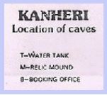
Guess what this is!
This is a map of the Buddhist caves at Kanheri. A bit like a rabbit warren, don't you think? Kanheri grew over a period of eight centuries to become one of Western India's largest Buddhist monk settlements. As it grew, the monks carved out more and more caves, until the entire hill was dotted with prayer halls, sleeping quarters and water tanks. Here's the key to the map. As you can see there are over a hundred caves - with lots of tanks and cisterns to store water.
 If you ever get to Kanheri, use the map to figure out how to get from cave to cave. The starting point is the Booking Office, which you can see illustrated at the bottom of the map.
It can be interesting. One overseas couple who tried it had this to say: "The map in the guide book looked bizarre. It was simply a series of dots and numbers that resembled a child's connect-the-dots puzzle. However, like so many other systems in India that seem totally illogical or unintelligible on the surface, those amazing little numbers helped us find all the caves we wanted to see in that honeycombed ravine. That was just as well, because there was no one to ask for directions!".
Kanheri is set well inside Sanjay Gandhi National Park, so it is calm and quiet and green, very different from Bombay's usual bustle and noise. See for yourself.


3 comments:
Nice! Reminds me of the "Valley of the Tombs" in egypt...
That's true!!! I did find all the caves on my own with the help of the map alone!!! Only had they mentioned the one with the cave painting on the ceiling also it would be easy to find. It is really wonderful to see a painting on the ceiling in one of the caves there. Have you seen it? There is a small guide book by Mr. Wani also available at the tea stall inside the entrance gate.
Cheers,
Aadil.
Aadil, glad you found the cave-hunting fun! I think Cave 10 is the one with the ceiling painting, but I might be wrong.
- Deepa
Post a Comment